The Mersey Flat's Role in the Coal Trade

Mersey flats transported coal, that was extracted from pits in Cheshire and Lancashire, along the navigable waterways of North West England. It was cheaper to transport coal along the water than by land but the tributaries of the River Mersey, at the turn of the eighteenth-century, were difficult to navigate. In 1720, however, Royal Assent was given to two Acts of Parliament that allowed the River Weaver and the River Irwell to be made navigable to trading vessels. Coal flats, from the time that the first river navigations were constructed, were able to supply the salt works of Cheshire as well as the home fires of Manchester with fossil fuels. Liverpool, the principle trading port of North West England, received a sizeable portion of the coal that was conveyed along the inland waterways. The first river navigations were built in the pre-industrial era, when agricultural produce and artisanal wares were the principle trading commodities, but the establishment of these water lines of communication laid the foundation for the Industrial Revolution. A scarcity of firewood in parts of North West England led to an increasing demand for coal while trading flats, navigating the inland waterways, were able to to supply the homesteads as well as the fledgling industrial areas with this mineral resource. Navigation companies, therefore, were able to profit from meeting the rising demand for coal and other commodities. Towards the end of the seventeenth-century, however, a new generation of navigable waterways emerged that threatened to overshadow the river lines of communication. Commercial rivalries existed between the canal companies and the river navigation companies of North West England while the arrival, in 1830, of the Liverpool and Manchester Railway threatened to render water lines of communication obsolete. Rail-to-ship transloading facilities at the docks of Birkenhead and Liverpool, however, allowed coal flats to supply steamships with bunker fuel.
Lancashire was Home to the Largest Coalfield in North West England.
Lancashire, home to the largest coalfield in North West England, and a large quantity of its output of fossil fuel was consumed by local markets. A letter, written by William Laird and addressed to Thomas Littledale, laments the declining fortunes of Liverpool in regards to the export trade in coal. A Letter to Thomas Littledale, Esq., Chairman of the Liverpool Dock Trust was published in 1850 and contained information about the Lancashire Coalfield, the volume of coal exported from the ports of Britain in the middle of the nineteenth-century as well as the lines of communication that facilitated the internal trade in that mineral resource. It is reported, on page 5, that the produce of the Lancashire Coalfield comprised a mere 2% of the coal export trade of Great Britain and Ireland. The economic prosperity of Liverpool, therefore, would have been improved by increasing the supply of coal for export. It is explained, on page 7, that the Lancashire Coalfield spanned a distance of 550 to 600 square miles. The Sankey Canal, Leeds and Liverpool as well as the Bridgewater Canal are identified as the three main water lines of communication between the Lancashire Coalfield and Liverpool on page. It is claimed that the Lancashire Coalfield, while being smaller than that of the East Country, possessed a greater variety of coal than those that could be found in the North East of England. Cannel coal, on page 11, is identified as a resource of particular interest due to the high quality of gas that could be extracted from it. The superior quality of gas available in Liverpool, in terms of cost and purity, is attributed to the unique characteristics of cannel coal sourced from the collieries of Lancashire. Water lines of communication, whether it was navigable canals or rivers, were an invaluable asset to the coal trade. Mersey flats, from the inception of the first navigation companies at the beginning of the eighteenth-century, played a prominent role in the coal trade of coal in North West England.
Coal Mining in Cheshire and Lancashire.
Robert Lindsay Galloway, on page 115 of the first volume of Annals of Coal Mining at the Coal Trade, states that Wigan was famous for its deposits of cannel coal from as early as the sixteenth-century while coal from the western part of the Lancashire Coalfield is reported to have been exported from Liverpool towards the end of that century. Chapter XVIII is dedicated to the history of coal mining in the seventeenth-century and mentions the cannel coal mine near Wigan, which was owned by Sir Roger Bradshaw, and a burning well. Cannel coal, due to its ease of ignition, was used in a similar fashion to candles and could be fashioned into eating implements. The burning well, which appeared to boil and would catch a flame, was caused by the passage of firedamp from the subterranean coal bed through the water. Chapter XIII of The Coal Fields of Great Britain, which was written by Edward Hull and published in 1873, is dedicated to the South Lancashire Coalfield while the previous chapter contains a brief entry about the Cheshire Coal Field. It explained, on page 188, that the lowest coal-bed of the middle coal-series was accessible at Little Delf in St. Helen's and Arley Mine in Wigan. St. Helen's was connected to the River Mersey, and therefore Liverpool, via the Sankey Canal while Wigan could transport coal to the port city via the Leeds and Liverpool Canal. The Cannel Mine at Wigan, which is described as the most valuable of all the mines, may have supplied Liverpool with the coal that William Laird describes on page 11 of his letter to Thomas Littledale. Samuel Lewis, on page 568 of A Topographical Dictionary of England, claims that cannel coal was transported along the River Douglas Navigation before its acquisition by the Leeds and Liverpool Canal Company. It is revealed that a navigation channel, which was excavated by the same canal company, connected the River Douglas with Wigan. An indirect communication, therefore, was established between the River Douglas and the River Mersey.
Land Routes were used for the Conveyance of Coal before the Emergence of the first Navigable Waterways.
A lack of canals or navigable rivers in Lancashire meant that coal, for the most part, had to be transported by pack animals or horse-drawn vehicles along the land routes. Horses were the main source of transportation before the invention of the steam locomotive, internal combustion engine or electric motor. Early fuel-burning engines, such as the atmospheric engine that Thomas Newcomen designed or the steam engine that James Watt invented, were too large to be used for transportation purposes and so the beast-of-burden remained the principle means of motive power before the arrival of the first steam-powered railways. Toll roads, such as the Prescot Turnpike, provided a more efficient means of transporting coal than the dirt roads and bridleways that had preceded them but land transportation remained inefficient. Water transport is described, on page 62 of Commercial Geography, as cheaper than land transport. Karl August Zehden and Findlay Muirhead, who published the book in 1889, state that water routes required less maintenance than land routes. Samuel Smiles, who published James Brindley and the Early Engineers in 1864, claims that the merchants of Manchester would export their wares by pack-horse before the arrival of water lines of communication with the rest of the county. The state of land transportation in pre-industrial England is described on Chapter VIII, which is dedicated to the inception and construction of the Bridgewater Canal, and includes the different types of road that were used. It is revealed, on page 162, that the roads that led out of Manchester were of a poor quality and were often unsuitable for wheeled vehicles. Pack-horses, which transported their wares in panniers or saddlebags, provided the principle mode of transport along the system of roads. It is reported, on page 164, that the roads were insufficient to supply Manchester with food and that this situation was not alleviated until the arrival of the first navigable waterways.
Canals and Navigable Rivers Decreased the Cost of Transporting Coal.
It could be argued that the development of water lines of communication in eighteenth and nineteenth-century Britain, such as those that interconnected with the River Mersey, allowed Britain to transition from an agricultural economy to an industrial economy. Increasing demand for coal in Liverpool, as well as the industrial centers that were emerging along the River Mersey and its tributaries, meant that the transport infrastructure in the region had to be improved. Coal: its History and Uses, which was edited by Professor Thorpe and published in 1878, describes the connection between the increase in mining operations in the Lancashire Coalfield and the development of navigable waterways in North West England. It is explained, on page 339, that the creation of the Bridgewater Canal was the catalyst which led to the increase in coal production in Lancashire. The Leeds and Liverpool Canal, by extension, is also credited for the development of coal mining in the region. It is stated that the purpose of these canals, which were created in the second half of the eighteenth-century, was to improve the means of transporting coal from inland mines to the domestic markets. The Industrial Revolution, therefore, would not have been possible without improvements to the water lines of communication that allowed the cheap transit of coal to the manufacturing centers. Abraham Reese describes the cheapness of transporting coal along the navigable waterways in the sixth volume of The Cyclopaedia; Or, Universal Dictionary of Arts, Science and Literature while remarking on the manner in which the Bridgewater Canal competed with the Mersey and Irwell Navigation. It is explained, in the section of the encyclopedia that deals with canals, that the Bridgewater Canal supplied Liverpool with coal at a cheaper rate than the Mersey and Irwell Navigation. Some forms of water communication, therefore, provided a more cost-effective means of transporting coal than others.
Horses can Haul more Coal along the Water than they can along the Land.
Inland navigations, whether they followed the course of natural rivers or artificial cuts, provided a more economical means of transporting coal than the land routes that had preceded them. Improvements to the rivers of North West England and the construction of the first canals allowed coal flats, which were often drawn by horses, to move between the collieries and the manufacturing towns. An article, which was published in the June of 1843, outlines the economic benefits of inland navigation while acknowledging the role of horses in the hauling of barges. The methods by which barges were moved along the navigable waterways is given its own section in the article, which is included in the twenty-second and twenty-third volume of The Saturday Magazine, and provides details about the use of horses in the water conveyance of freight. Horses, on page 241, are revealed to be able to haul greater loads along the water than they can by land. It is claimed, on page 247, that horses were capable of drawing barges at a rate of three to four miles-per-hour while an old horse could haul twenty to thirty-tons of freight along the water. Thomas Grahame, on page 17 and 18 of To the Unincorporated Traders and Carriers on the Canals and River Navigations Connecting the Towns of Liverpool and Manchester, claims that horses can perform a greater amount of work when hauling barges along the water than they can when drawing carts along the land. It is stated that two horses, when hauling a boat along the Bridgewater Canal, can perform twelve times the amount of work as four horses that are engaged in the act of drawing road vehicles. The Costume of Great Britain, written by William Henry Pyne and published in 1808, contains a chapter about barges that includes information about the use of horses in water transportation. It is revealed that one horse, when tethered to a barge, can haul the same amount of weight along the water as it would take thirty horses to tow across the land.
Inland Waterways that were Navigated by Coal Flats.
Coal flats were among the trading vessels that operated on the River Weaver Navigation as well as the Mersey and Irwell Navigation, which were the first canalized waterways in North West England, while the Sankey Brook Navigation established a water line of communication between the collieries of St. Helen's and the River Mersey. New routes for the water carriage of coal arrived when the Bridgewater Canal, Rochdale Canal as well as the Leeds and Liverpool Canal opened later in the eighteenth-century. Trading flats, including those that operated on the River Mersey, were known to operate on the western portion of these canals. Joseph Priestly reveals the tonnage rates of these navigable waterways in Historical Account of the Navigable Rivers, Canals and Railways of Great Britain while listing coal as being among the cargoes carried along the inland navigations. Coal flats are known to have operated on the Douglas Navigation, which is situated in Lancashire, before it was connected to the wider network of inland waterways. It is revealed, on page 421, that the Douglas Navigation had existed as an independent entity before its acquisition by the proprietors of the Leeds and Liverpool Canal. This waterway, which was divided into the Lower Douglas Navigation and Upper Douglas Navigation after its annexation, provided a water line of communication between Wigan and the River Ribble. The River Douglas Navigation, at the time of its construction, predated the system of canals in Britain and had no inland water line of communication with the River Mersey. Vessels that used the navigation, however, would be able to access the coast via the Ribble Estuary. Rodolph de Salis, on page 358 of Bradshaw's Canals and Navigable Rivers of England and Wales, reports that Bridgewater Canal lighters as well as Mersey flats operated on the Manchester Ship Canal. Mersey flats, some of which were involved in the coal trade, are known to have navigated the Wirral Line of the Ellesmere Canal.
Different Types of Coal Flat that Operated along the Navigable Waterways.
Henry Rodolph de Salis, on page 21 of Bradshaw's Canals and Navigable Rivers of England and Wales, differentiates between different types of trading craft that operated on the inland waterways of North West England. Mersey flats, Weaver flats and Bridgewater Canal lighters are described as distinct types of vessel while similarities between the three are acknowledged. It is claimed that Mersey flats, which are reported to have had the capacity to carry eighty-tons of freight, were between 68 and 70-feet in length as well as 14-feet and 3-inches to 14-feet and 9-inches in beam. Weaver flats, by contrast, are claimed to have been 90-feet in length and 21-feet in beam while their carrying capacity is stated to have been 250-tons. Bridgewater Canal lighters, which are reported to have had similar dimensions to Mersey flats, possessed open holds that were able to carry fifty-tons of freight. Coal, whether it was being exported or imported, was conveyed along the inland navigations by the three types of trading vessel. It is revealed that sailing vessels of the River Weaver, which were known as Number One flats, had become rare at the beginning of the twentieth-century. Black flats, which are described on page 6, are reported to have been sailing vessels that were employed on the River Weaver Navigation and it is probable that these vessels were synonymous with Number One flats. Marmaduke Tulket, on page 27 of History of the Borough of Preston, mentions that coal flats operated on the River Ribble. A communication is reported to have existed between the River Ribble and the River Douglas Navigation, along which coal is reported to have been conveyed to Preston, and the same coal flats that navigated the River Ribble may have operated on its tributary river. Coal flats that navigated the River Douglas, before its connection with the Leeds and Liverpool Canal, may be regarded as a distinct type of vessel from its cousins that navigated the system of waterways that were connected to the River Mersey.
Sailing Flats and the Sea Trade in Coal.
Sailing flats, such as those which operated between St. Helen's and Liverpool, that were employed in the coal trade were not confined to the inland waterways. Gaff-rigged, sloop-rigged and ketch-rigged trading flats made sea voyages to Cumbria, North Wales as well as the East Coast of Ireland. Hugh Oakeley Arnold-Forster, on page 277 of The World is Ours: an Introduction to the Study of Geography, claims that it is cheaper to transport freight along the sea routes than it is to convey goods along the inland routes. It is reported, in the first article that appears in the fifth volume of New Ireland Review, that sea carriage is a cheaper mode of commercial transportation than carriage along the inland waterways. The claim is found in Inland Transport, which was composed by a Director of the Grand Canal Company and published by the New Ireland Review Offices in the March of 1896, which compares the cost of transporting goods by sea and by land. It is claimed, on page 3, that the the cost-effectiveness of sea transport increases with the size of the merchant vessel. It may be inferred that Mersey flats, when compared to larger merchantmen, were better suited to the transportation of coal along the inland waterways than they were to the shipment of coal along the sea routes. Trading flats, while not uniform in size, had a capacity to carry between fifty and eighty-tons in weight while larger merchant ships could far exceed this. Sailing flats, however, are known to have exported coal along the coast and imported mineral resources along the same sea routes. Michael Stammers, on page 101 of Mersey Flats and Flatmen, claims that coal flats travelled as far south as North Wales and as far north as the Ribble Estuary. It is claimed that two coastal flats arrived at Lytham Dock on the 25th of June, 1916, and unloaded sixty-two tons of coal. Sailing flats, on page 102, are reported to have imported coal to the Dovey Estuary and returned to the River Mersey with a cargo of lead ore.
Shipbuilding Firms that Constructed Mersey Flats.
Clare and Ridgeway, on page 26 of The Commercial Directory of Liverpool and Shipping Guide, are listed as builders and proprietors of flats. The trading barges of North West England, known as flats, came in a variety of different forms and Mersey flats were one of several types. The directory, which was published in 1875, names T.A. Macardle as the Liverpool agent of the shipbuilding firm. The Liverpool Commercial List, which covers the years from 1885 to 1886, claims that the shipbuilding firm was located at Sankey Bridge in Warrington. It is claimed that Clare and Ridgeway, who are identified as builders of Mersey flats, traded coal as well as lime. The Mercantile Navy List and Maritime Directory, which was published in 1925 by the General Register and Record Office of Shipping and Seamen, lists Eustace Carey as having been built at Sankey Bridges. It is claimed that the merchant vessel, which was launched in 1905, was owned by United Alkali Company Limited and that the headquarters of the chemical firm was situated in Liverpool. Michael Stammers, on page 111 of Mersey Flats and Flatmen, identifies Eustace Carey as the penultimate sailing flat to be built by Clare and Ridgeway while Santa Rosa was the final vessel of that type to be completed. Eustace Carey and Santa Rosa are identified as jigger flats, which were ketch-rigged sailing flats, while United Alkali Company Limited are revealed to have purchased the vessels. The fifth chapter of Mersey Flats and Flatmen by Michael Stammers, which runs from page 77 to 93, is dedicated to the firms who built these vessels. Abel's are reported, on page 76, to have constructed Mersey flats at their Castlerock Yard at Runcorn. Thomas Holland, on page 78, is named as a builder of trading flats for a variety of navigation companies. It is claimed, on page 80, that the Duke of Bridgewater established his own flat building facilities at Worsley. Two hundred men, from the seventeen-sixties onwards, are reported to have been employed at the boatyard.
Liverpool Develops from a Minor Coastal Town into a Thriving Commercial Port.
Edward Cresy, on Chapter VIII of An Encyclopaedia of Civil Engineering, describes the evolution of Liverpool from a minor coastal town into a thriving commercial port. The author published his encyclopedia in 1847, at which point a number of docks were under construction, and it may be said that the fortunes of the commercial port were improving. It is claimed, on page 359, that Liverpool began to increase in importance during the reign of William III while the first floating dock is reported to have been constructed during the reign of Queen Anne. It is reported that Salthouse Dock, which was built in the reign of George II, was the second dock to be completed in the emerging port. A third dock, which is identified as St George's Dock, is claimed to have been constructed during the reign of the third Hanoverian monarch. It is revealed that the docks, during the middle of the nineteenth-century, were interconnected and this allowed the passage of marine traffic between them. Flat-bottomed boats, which may refer to Mersey flats, are reported to have used in the scouring and dredging of the docks before more convenient means of cleaning the basins were implemented. Liverpool, at the time in which the encyclopedia was published, is described as being the second most prosperous commercial port after London. It appears, however, that Liverpool was more of a consumer of coal by the middle of the nineteenth-century than an exporter of the fossil fuel. William Laird, on page 4 of The Export Coal Trade of Liverpool, reports that 242,408-tons of coal were exported from Lancashire in 1848 and that this quantity paled in comparison to the amount that was exported from the North East of England. Liverpool, whose coal output is included in that of Lancashire, exported 18,393-tons of the mineral resource along the coast and 113,554-tons to foreign markets. Local demand for coal, which included the salt and alkali industries, may help to explain the lower volumes of fossil fuels being exported from Liverpool.
Birkenhead Docks Provide Shelter to Coal Flats.
Birkenhead, which is situated on the opposite side of the River Mersey from Liverpool, established its own network of docks that could accommodate Mersey flats. Mawdsley and Son's Directory of Wirral, Including Birkenhead contains a chapter about the system of docks that emerged on the other side of the River Mersey from Liverpool. The directory, which was published in 1861, describes the establishment of a shipyard at Birkenhead by William Laird. The property, which was purchased from Francis Richard Price in 1824, was situated at Wallasey Pool. An Act of Parliament, which was granted Royal Assent in the July of 1844, allowed the first docks at Birkenhead to be constructed. It is revealed that on the 23rd of October, 1844, the foundation stone of the Birkenhead Docks was laid down by Sir Philip de Malpas Grey Egerton. John Laird, the son of William Laird, had acquired more of the Wallasey Pool property from the Corporation of Liverpool and sought to construct of series of docks there. Morpeth Dock and Egerton Dock were opened on the 5th of April, 1847, despite opposition from the Corporation of Liverpool. The Mersey Conservancy Bill, which was passed in 1857, placed the docks on both sides of the river under the control of the Mersey Docks and Harbour Board. Thomas Webster, on page 171 of Minutes of Evidence and Proceedings on the Liverpool and Birkenhead Dock Bills of 1855 and 1856, reports that Mersey flats were frequent visitors to the Birkenhead Docks. It is stated that coal flats, when no accommodation was available at Liverpool Docks, would take refuge at Birkenhead Docks. Flatmen, who did not wish to remain at anchor on the River Mersey, sought shelter at the Birkenhead Docks while the proprietors of the docks provided this service free of charge. Morpeth Dock is named, on page 313, as one of the docks that were used by Mersey flats. Coal, once sold, was discharged from Mersey flats into the holds of seagoing ships.
Coal Flats Supply Steamships with Bunker Fuel at the Liverpool Docks.
Liverpool, from the construction of the first dock at the beginning of the eighteenth-century until the arrival of the first railway connections in the eighteen-thirties, imported coal from Wales along the sea lines of communication. Sailing flats, while better suited to work on the inland waterways, were known to receive cargo in North Wales. Samuel Salt provides statistics for the volumes of coal supplied to steamships in the Port of Liverpool in Facts and Figures, Principally Relating to Railways and Commerce while explaining that Mersey flats were involved in the bunkering of steam vessels. It is revealed, on page 61, that coal flats from St. Helen's received 110,000-tons of coal in 1844 and bunkered steamships which operated along the sea routes that connected Liverpool to the West Coast of Ireland. Steamships from the Isle of Man, Scotland and the West Coast of England are also reported to have been bunkered in Liverpool by Mersey flats that received coal from St. Helen's. The City of Dublin Steam Packet Company, receiving 32,000-tons of coal, are reported to have received the largest quantity of fuel from the coal flats in Liverpool. It is claimed that the Drogheda Company, which used coal as ballast, were supplied with 18,000-tons of fuel while 14,000-tons of coal was consumed by government mail boats. Coal from St. Helen's was transported to Liverpool via the inland navigations while railways, from the eighteen-forties onwards, transported coal from North Wales to the Mersey Estuary. Railways may have reduced the sea trade of coal but sailing flats, active in Liverpool Docks, continued to supply steam ships with bunker fuel. Edward Patrick Cotter, on page 120 of The Port of Liverpool, reports that Mersey flats supplied liners with most of their coal. The United States Department of Commerce and the United States Shipping Board, who published the report in 1929, state that Mersey flats were still bunkering steamships in the second decade of the twentieth-century.
The Liverpool & Manchester Railway Provides an Alternative Means for the Conveyance of Coal and the Navigation Companies Voice their Objections.
James Scott Walker, on page 6 of An Account of the Liverpool and Manchester Railway, claims that three inland navigation companies opposed the construction of the first railway in the North West of England. The Bridgewater Canal as well as the Leeds and Liverpool Canal are named as two of the companies that opposed the creation of a rail line of communication between the two cities while the Mersey and Irwell Navigation, which was not a canal in the truest sense, joined its fellow navigation companies in their attempts to prevent the railway from being constructed. It is claimed, on page 8, that communication would be established between the railway and the coal producing areas. Navigation companies, which had enjoyed a virtual monopoly on this trade, would have felt threatened by this development. A Bill, permitting the creation of the Liverpool and Manchester Railway, was passed by the Houses of Parliament in the February of 1826 while George Stephenson was chosen as the principle engineer. It is revealed that coal was loaded and unloaded at Wapping, which was situated in Liverpool, while Queen's Dock is reported to have been a short distance from the railway terminus. Steam locomotives, which hauled coal trains along the railway, threatened to make coal flats redundant. The Sankey Viaduct, along which the Liverpool & Manchester Railway passed over the St. Helen's Canal, provides a tangible example of the direct competition that existed between the railways and the navigable waterways. The steam locomotive, hauling a train of coal carriages over the Sankey Brook Navigation, threatened to supersede the Mersey flats that traded on the navigable waterway below. Thomas Grahame, on page 26 of A Letter to the Traders and Carriers on the Navigations Connecting Liverpool and Manchester, states that the Liverpool and Manchester Railway was unable to deprive the navigation companies of a significant portion of their trade.
An Act of Parliament Authorizes the Construction of the Chester and Birkenhead Railway.
On the 12th of July, 1837, An Act for making a Railway from the City of Chester to Birkenhead was given Royal Assent. The fifty-sixth volume of Reports of Commissioners, which was published in 1837, contains the title and the date of the piece of legislature that allowed a rail line of communication to be opened between Chester and Birkenhead. Special Reports of Committees on Railway Bills Relating to the Adoption or Rejection of the Recommendations of the Board of Trade, which was published in 1845, provides details about the formation of a railway extension between Grange Lane and Wallasey Pool. Details of the Chester and Birkenhead Railway Extension, which can be found of page 8, do not include the date of the relevant Act of Parliament. On the 10th of October, 1844, a report about the Chester and Birkenhead Railway Extension was composed by Captain Coddington. Major-General Charles William Pasley, who was himself a railway engineer, forwarded the report to the House of Lords. The Mersey Branch of the Chester and Birkenhead Railway, as the extension was also known, is claimed to have been three-quarters of a mile in length. The report can be found on pages 448 and 449 of the thirty-ninth volume of Parliamentary Papers, which was published in 1846, that describes the manner in which the extension formed a line of communication between the railway and the River Mersey. The Railways of Great Britain and Ireland, which was written by Francis Wishaw, includes a chapter on the Chester and Birkenhead Railway. It is revealed, on page 54, that a viaduct carried the railway over the Ellesmere Canal at Moston. The seventeenth volume of The Sessional Papers Printed By Order of the House of Lords, which was published in 1837, explains that trading flats had transported goods from Chester to Liverpool before the introduction of the Chester and Birkenhead Railway. It is revealed, on page 21, that goods were conveyed to the River Mersey via the River Dee or Ellesmere Canal.
The Chester and Birkenhead Railway is Incorporated with the Birkenhead, Lancashire and Cheshire Junction Railway.
It did not take long for the Chester and Birkenhead Railway, which posed a threat to the inland navigation companies that communicated with the River Mersey, to be amalgamated with another railway company. Railway communication was established with Birkenhead, which was situated on the Wirral Peninsula, in the same decade that Morpeth Dock and Egerton Dock were built. The second part of the eighteenth volume of The Statutes of the United Kingdom of Great Britain and Ireland, which was published in 1847, provides the title as well as the date of the Act of Parliament that authorized the amalgamation of the two railway companies. On the 22nd of July, 1847, the Act of Parliament was given Royal Assent. An Act for enabling the Chester and Birkenhead Railway with the Birkenhead, Lancashire and Cheshire Junction Railway passed during the first year of the reign of Queen Victoria. David Purdie Thompson includes a chapter on Birkenhead in The Stranger's Vade Mecum: Or, Liverpool Described that mentions the docks, their communication with the River Mersey and the relationship of the town with other settlements in the area. Birkenhead and Wallasey are revealed, on page 195, to be divided by the Great Float while communication between the large body of water and the River Mersey is claimed to have been established via a low water basin. It is revealed that Egerton Dock and Morpeth Dock were opened on the 5th of April, 1847, while Lord Morpeth is reported to have opened the branch line between the main railway and the river wharf on the same day. Coal from North Wales is revealed, on page 50 of the first volume of The Mining and Smelting Magazine, to have been exported from Birkenhead. Henry Curwen Salmon edited the magazine, which was published in 1862, and reveals that coal was exported from Birkenhead at the rate of 2 d. a ton. It is revealed, however, that the cost of exporting coal from Birkenhead increased to 3 1/4 d. per ton after the docks were acquired by the Mersey Board.
Birkenhead Docks are Acquired by the Mersey Docks and Harbour Board.
It is claimed, on page 120 of Handbook for Lancashire, that the Birkenhead Docks were annexed by the Mersey Docks and Harbor Board in 1858 while improvements to the infrastructure are reported to have been made after the acquisition. Robert Thubron claims, on page 82 of The Port Charges of Great Britain and Ireland, that the Mersey Docks and Harbour Board charged 3 d. to load trading flats with coal. It is revealed, on page 75 of the eighth volume of Transactions of the Liverpool Engineering Society, that the majority of the coal that was exported from Liverpool originated in North Wales and South Wales. The compilation of documents, which was published in 1887, was edited by J. H. T. Turner and pertains to matters concerning the rail-to-ship transloading of coal at the docks of Birkenhead as well as Liverpool. The Coal Shipping Appliances of the Port of Liverpool was delivered on 5th of October, 1887, by F. Hudleston and is reproduced in the collection of official documents that was published by the Liverpool Engineering Society. Coal flats are reported, on page 77, to have been loaded by a hand tip that was installed in 1872 and situated at the south end of the Liverpool High Level Coal Railway. The hand tip that was in use at the Liverpool High Level Coal Railway is claimed to have been similar to that which was used at Birkenhead. It is revealed, on page 80, that Birkenhead received its first coaling appliances in 1861 while it is claimed that the Great Western Railway as well as the London and North Western Railway supplied the coal. Hand tips are revealed, on page 81, to have been used to load Mersey flats with bunker coal at Birkenhead Docks. It is claimed that 80,000-tons of bunker coal, which originated from South Wales, was transshipped at Birkenhead Docks every year. It is reported, on page 82, that an average of 2,000-tons of coal had been exported each year from Birkenhead and Liverpool since 1880 while sixty percent of the coal was used as bunker fuel.
The Inland Navigations of North West England Survive the Introduction of the Railways.
Growing dissatisfaction with the navigation companies at the beginning of the nineteenth-century, along with the introduction of the first railways, threatened the commercial viability of water lines of communication. The navigation companies, however, were able to recover from the initial onslaught of the railway companies and become competitive once again. The first issue of Report on Steam Carriage, which was published by a Select Committee of the House of Commons in 1832, maintains that water carriage was a cheaper means of conveying goods than railways. It is reported, on page 269, that the price of water conveyance was reduced after the arrival of the railways. The proprietors of the navigation companies, of which the Mersey and Irwell Navigation as well as the Bridgewater Canal are given as examples, had established monopolies over the transit of goods while the establishment of railways in the region had compelled them to provide their services at a more competitive price. Ewing Matheson, on page 352 of Aid Book to Engineering Enterprise, contends that it was cheaper to transport mineral resources by water carriage than it was by railway. It is stated that Britain, at the close of the nineteenth-century, owed its industrial supremacy to the network of navigable waterways and other cost-efficient lines of communication. Chapter XV of the book, which was published in 1898, is dedicated to the mining of coal and other raw materials. The ability to profit from the extraction of mineral resources is identified, on pages 348 and 349, as a deciding factor in whether or not a mining operation should be embarked upon. It is explained, on pages 350 and 351, that the cost of transportation of raw materials determined whether or not a mining venture was profitable. It is stated, on page 363, that railways had to restrict the amount of money that they charged to transport coal because it was cheaper to convey that raw material along the water.
Integration of the Navigation Companies and Railway Companies Provides Coal Flats with New Opportunities.
James Scott Walker, on page 7 of An Account of the Liverpool and Manchester Railway, reveals that some investors who owned shares in navigation companies also purchased shares in railway companies. It is claimed that the Marquis of Stafford, who had interests in the Bridgewater Canal, bought one-thousand shares in the Liverpool and Manchester Railway. Investing in these rival modes of conveyance foreshadowed the establishment of companies, such as the London & Northwestern Railway, that owned rail and water transport infrastructure. Between the 5th of May and the 5th of June, 1856, a Bill was submitted to the House of Commons that promoted the construction of new basins at Birkenhead Docks. The document, which is entitled Birkenhead Docks Bill, details the opposition to the construction project by certain transportation companies that were in communication with the docks. Among the parties that opposed the Bill was the Birkenhead, Lancashire and Cheshire Junction Railway Company. Thomas Webster, who includes the document in Minutes of Evidence and Proceedings on the Liverpool and Birkenhead Dock Bills in the Sessions of 1855 and 1856, was counsel to the railway company that opposed the Bill. It is revealed, on page 312, that a railway line existed between the collieries of North Wales and Birkenhead Docks. Coal, which was transported to Birkenhead via the Cheshire Junction Railway, is reported to have been loaded into Mersey flats and taken to Liverpool for transshipment. The second volume of the British Islands Pilot, which was published in 1915 by the Hydrographic Office of the United States, claims that the St. Helen's Canal was owned by the London & Northwestern Railway during the First World War. Mersey flats, on page 426, are identified as the main carrying craft that operated on the canal. Widnes Wet Dock, which contained rail-to-ship transloading facilities, is reported to have been owned by the London & Northwestern Railway.
Upper Mersey Navigation.
Henry Rodolph de Salis, from pages 245 to 248 of Bradshaw's Canals and Navigable Rivers, provides information about the Upper Mersey Navigation. It is claimed that the navigable section of the river was situated between Bank Quay, Warrington and Liverpool while the Upper Mersey Navigation Commissioners are claimed to have held jurisdiction over this section of the watercourse. The commissioners, whose office was situated at Runcorn, did not have jurisdiction over the entire river or its connecting waterways. It is explained, on page 147, that the stretch of the river between Liverpool and Warrington was as low as one foot and six inches during neap tides. Mersey flats are reported, on page 248, to have navigated the upper reaches of the river. The Upper Mersey is mentioned on page 356 of the forth edition of Sailing Directions for the West Coast of England, which was published in 1891 by the Hydrographic Department of Great Britain, while Garston Docks are reported to be the place at which the upper navigation of the river commences. Vessels with a draught of seven feet, which would include Mersey flats, are reported to have been able to access Warrington during spring tides. It is revealed, on page 357, that Garston Docks were opened in the June of 1875 and were furnished with eight high level coal tips. Robert Edmonson asked whether he should file a complaint against his coal merchant or the London and North West Railway on the 22nd of June, 1875, after he was detained for ten days while waiting for his ship to be loaded with coal at Garston Docks. It is claimed that several Mersey flats, which may have been involved in the transportation of coal, entered the dock while the ship was delayed. This report can be found on page 16 of the third volume of Maritime Notes and Queries, which was published in 1881, while it is revealed that the railway company would not be held liable for the delay if it had not entered into a contract with the concerned parties.
Royal Assent is Given to Six Acts of Parliament for Making the River Dee Navigable.
Chapter V of Sailing Directions for the West Coast Pilot, which was compiled by Captain E. J. Bedford and published in 1870, is dedicated to the stretch of coastline between Great Ormes Head to Formby Point. It is explained, on page 116, that the course of the River Dee was diverted into an artificial cut between Chester and St Mark's. The watercourse, at the point at which it reached St Mark's, is claimed to have discharged into the Dee Estuary. Large quantities of coal are reported, on page 124, to have been loaded onto ships at Mostyn Quay. An open dock is stated to have existed at the quay and ships with a draught of 12-feet were able to berth here during spring tides while vessels with a draught of 6-feet, which may have included trading flats, were able to access the quay during neap tides. It is reported, on page 125, that trading flats would navigate the River Dee from Chester to Mostyn Deep and transload goods into merchant ships that were anchored there. Saltney Quay is revealed, on page 126, to have been accessible to ships of 150-tons burthen while vessels with a maximum draught of 7-feet are claimed to have been able to access the wharf at low water. Joseph Priestly states that Royal Assent was given to six Acts of Parliament for making the River Dee Navigable in Historical Account of the Navigable Rivers, Canals, and Railways Throughout Great Britain while providing information about the rates that were charged for the conveyance of goods. On the 11th of April, 1700, William III is reported to have given his Royal Assent to the original Act of Parliament that permitted the River Dee to be made navigable for vessels of 100-tons burthen. It is revealed, on page 206, that the first Act allowed the proprietors of the river navigation to collect rates on coal as well as lime and limestone. The seventeenth volume of The Sessional Papers Printed by Order of the House of Lords, which was published in 1837, reports that trading flats navigated the River Dee as they operated between Liverpool and Chester.
William Squires and Thomas Steers are Hired to Make the River Douglas Navigable from Wigan to the River Ribble.
Richard Brooke, on page 104 of Liverpool as it was During the Last Quarter of the Eighteenth Century, claims that an Act of Parliament was passed in 1719 that permitted the River Douglas to be made navigable between the River Ribble and Wigan. Improving the River Douglas for navigation would allow coal, mined from pits in Wigan, to be transported to the northern parts of Lancashire. Limestone and slate, in turn, would be imported along the water line of communication. It is revealed that the Act that authorized the construction of the river navigation, which was not completed until 1727, was passed during the sixth Parliament of the first Hanoverian monarch of Great Britain. The ninth volume of The Beauties of England and Wales, which was composed by multiple authors and published in 1807, includes the River Douglas Navigation in its description of the inland waterways of Lancashire. It is explained, on page 24, that several collieries existed in the Wigan area and that the proprietors of the mines required a navigable waterway to transport their coal to the Ribble Estuary. William Squires and Thomas Steers are identified, on page 30, as the engineers who oversaw the creation of the river navigation. Marmaduke Tulket, on page 27 of History of the Borough of Preston, reports that Preston was supplied with coal via the River Douglas Navigation and claims that coal flats operated in the Ribble Estuary. Michael Stammers, on page 78 of Mersey Flats and Flatmen, reports that Thomas Holland built a trading flat for the proprietors of the River Douglas Navigation. Concorde, built between the years 1742 and 1743, is reported to have been built at Wigan. It is probable that the Douglas flat, which was constructed at Miry Lane, was involved in the coal trade. Abraham Rees states that Miry Lane was the southern terminus of the River Douglas Navigation in the sixth volume of The Cyclopaedia, Or, Universal Dictionary of Arts, Sciences, and Literature while naming the River Ribble as its northern terminus.
An Act of Parliament is Passed to Make the River Irwell and River Mersey Navigable from Manchester to Liverpool.
Henry Rudolph de Salis reports, on page 16 of A Chronology of Inland Navigation in Britain, that an Act of Parliament was passed in 1720 that allowed the River Irwell and the River Mersey to be made navigable from Manchester to Liverpool. Historical Account of the Navigable Rivers, Canals and Railways of Great Britain identifies two Acts of Parliament that authorized the creation of the river navigation while describing the process in which it was built, the manner in which it was funded as well as the tonnage rates that were charged for its use. Joseph Priestly, who published his history of inland navigation and railways in 1831, states that the first Act of Parliament was given Royal Assent on the 28th of March. The navigation company was allowed to scour the rivers, excavate navigation channels as well as construct bridges, locks, sluices and weirs. It is explained, on page 448, that the undertakers of the navigation company were able to charge 3s. 4d. for the transport of coal along the navigable waterway. Goods that were transported from Bank Quay to Liverpool, which followed the course of the River Mersey, were not subject to the rates. On the 17th of March, 1794, a Second Act of Parliament created the Company of Proprietors of the Mersey and Irwell Navigation. Henry Booth, on pages 4 and 5 of An Account of the Liverpool and Manchester Railway, names the river navigation as being one of two water lines of communication that linked Liverpool with Manchester. It is claimed, however, that the Act of Parliament that permitted the establishment of the Mersey and Irwell Navigation was passed in 1733 while other sources provide a different date. Mersey flats are identified, on page 5, as the principle trading craft that operated on the river navigation. Frederick Smeeton Williams includes a description of the trading flats that served on the navigable waterway in Our Iron Roads: their History, Construction and Social Influences while providing information about the proprietors of the vessels.
Land Carriage Providers are Unable to Compete with the Mersey and Irwell Navigation.
Samuel Smiles, on page 164 of James Brindley and the Early Engineers, blames the poor state of communications between Manchester and the rest of England for shortages of food and fuel in Manchester. Land carriage, which was expensive and unable to meet the demand for provisions in pre-industrial Manchester, was performed by pack animals. It is revealed that the dearth of coal, which was conveyed from the local pits by pack horses, made it difficult for Mancunians to heat their homes in winter. The Mersey and Irwell Navigation, it is explained on page 165, did little to alleviate the shortages of coal in the manufacturing town because it did not communicate with the local collieries. It is explained, on pages 164 and 165, that horses were capable of carrying 280lbs. of coal while the local pits are reported to have charged 10d. for each horse-load. The cost of land carriage, however, doubled the price of coal when it arrived at the marketplace. It is claimed that the Mersey and Irwell Navigation allowed goods, which included coal, to be transported at a cheaper rate than the land carriage providers were able to charge. Goods, which were loaded into the holds of trading flats, were conveyed between Liverpool and Manchester at a rate of 12s. a ton while the same weight of goods would be transported along the land routes for 40 s. per ton. Coal flats, therefore, were superseding the role of pack horses and other forms of land carriage that operated between the manufacturing town and the seaport. It is worth noting, however, that men hauled the trading flats along the river navigation while horses were not used for this purpose until the arrival of the Bridgewater Canal. Samuel Salt, on page 82 of Statistics and Calculations Essentially Necessary to Persons Connected with Railways or Canals, reiterates the claim that the price of water carriage along the Mersey and Irwell Navigation was 12 shillings per ton while the cost of land carriage was 40 shillings per ton.
Declining Fortunes of the Mersey and Irwell Navigation.
One of the most significant blows to the fortunes of the Mersey and Irwell Navigation, aside from the introduction of the Bridgewater Canal, was the arrival of the railways. James Wheeler describes the manner in which the river navigation was able compete with its rival modes of transit in Manchester: its Political, Social and Commercial History, Ancient and Modern while explaining the unique position that the proprietors of the navigable waterway found themselves in. It is explained, on page 299, that the Old Quay Company was the only navigation company that could compete with the railways. The Old Quay Company, that owned the Mersey and Irwell Navigation as well as its trading flats, was able to impose whatever rate that they desired upon those who traded along the navigable waterway. It is revealed, on page 300, that the navigation companies were able to transport goods at a cheaper rate than the railways while the railways were able to convey freight at a faster pace. Henry Rudolph De Salis, on page 73 of A Chronology of Inland Navigation in Britain, claims that the Bridgewater Trustees purchased the Mersey and Irwell Navigation. The navigation, which was bought in 1844, remained in use but the Old Quay Company ceased to exist as a result of the acquisition. It is revealed, on page 35 of the second volume of Law Reports, that the Manchester Ship Canal bought the Bridgewater Navigation Company for the sum of £1,710,000 and this purchase would have included all of the acquisitions made by the company. On the 4th of August, 1887, the Bridgewater Canal Company is reported to have ceased business. Bradshaw's Railway Manual, Shareholders Guide and Directory 1889 lists the Bridgewater Canal, the Mersey and Irwell Navigation as well as the Runcorn and Weston Canal as among the navigable waterways that were purchased. An Act of Parliament that was dated to the 6th of August, 1885, allowed the Manchester Ship Canal to buy the Bridgewater Navigation Company.
The River Weaver is made Navigable for the Export of Salt.
The River Weaver, which is a tributary of the River Mersey, was made navigable for the export of salt and the import of coal. Thomas Baines names Lawton, Northwich and Winsford as the sites in which rock salt was excavated in Lancashire and Cheshire, Past and Present while claiming that the mineral resource was first discovered in Marbury. The two-volume history of Cheshire and Lancashire, which was written with the assistance of William Fairbairn and published in 1869, describes the manner in which the Cheshire salt industry inspired the creation of the River Weaver Navigation. Sir Charles Lyell is quoted, on page 150, as saying that the brine springs of Northwich and Winsford contained a volume of salt that was twenty-five per cent of its weight while the brine of Nantwich is claimed to have possessed a similar concentration of sodium chloride. The saline content of the brine springs of Nantwich, Northwich and Winsford is stated to have been higher than that of the sea water that is found in the English Channel. Braithwaite Poole, on page 36 of The Commerce of Liverpool, states that there were over four-hundred trading flats on the River Weaver Navigation by the middle of the nineteenth-century. It is reported that half of these Weaver flats were owned by the proprietors of the salt works while the other half, which were designated Number One flats, tended to be owned by other commercial interests. Weaver flats, which are reported to have had a carrying capacity of between 80 and 120-tons, are stated to have made fifty voyages to and from Liverpool a year. An entire chapter of the book, which was published in 1854, is dedicated to the salt trade and the water carriage of this mineral resource is explored in depth. An article that was published in the first volume of Illustrated Times on the 5th of February, 1859, describes the use of trading flats by the proprietors of the brine works in the valley of the River Weaver while highlighting the use of coal in the manufacturing of salt from brine.
Six Acts of Parliament for Making the River Weaver Navigable are given Royal Assent.
William Henry Pyne, writing in 1831, claims that work began on the River Weaver Navigation in 1720 while the date of its completion is not mentioned. Lancashire Illustrated, from drawings by S. Austin [and others] with descriptions (by W.H. Pyne &c.) illuminates the manner in which the river navigation strengthened the commercial ties between the salt-works of the valley of the River Weaver and the seaport of Liverpool. It is claimed, on page 8, that a large quantity of vessels exported rock-salt along this commercial waterway while coal is reported to have been imported along the same river. The seventy-sixth volume of Minutes of Proceedings of the Institution of Civil Engineers, which was published in 1884, concurs with Pyne about the date on which work on the navigation began. It is reported in the first volume of The Athenaeum, which was published in 1807, that the River Weaver Navigation was constructed in 1721 while the first volume of Engineering concurs with The Athenaeum about the date in which work commenced on the inland waterway. The journal, which was published in 1866, claims that a series of weirs and locks were constructed to improve the navigability of the river. Joseph Priestly includes a chapter on the inland navigation in Historical Account of the Navigable Rivers, Canals and Railways of Great Britain in which the six Acts of Parliament that pertained to the construction of the navigable waterway are listed. Parliamentary documents, which contain details of the laws that authorized the creation of the commercial waterway, are included in the chapter. Acts of Parliament for improving the navigability of the River Weaver are reported to have been given Royal Assent in 1720, 1734, 1760, 1807, 1825 and 1829 while coal, cannel coal, charcoal, coke as well as cinders are identified as the cargoes that were transported along the inland navigation. On the 23rd of March, 1720, Royal Assent was given to the first Act of Parliament that authorized the construction of the River Weaver Navigation.
Weaver Flats Export Salt to Liverpool and Import Coal from St. Helen's.
Thomas Kaye, on pages 128 and 129 of The Stranger in Liverpool, describes a triangular trade route that linked the salt producing towns of Cheshire with the seaport of Liverpool as well as the coalmines of St. Helen's. Trading flats, which exported salt to Liverpool via the River Weaver Navigation and the River Mersey, returned to the salt-works of Cheshire with coal from St. Helens. It is revealed, on page 88, that it was cheaper to transport coal and salt by water than it was to move those cargoes along the land routes. Creating a navigable waterway, therefore, between the salt fields of Cheshire and the River Mersey was an economic necessity. Direct access to Liverpool, which is described as the principle seaport from which salt was exported to domestic and foreign markets, could be attained via the River Mersey. It is explained that firewood, which was harvested from the forests that lay near Nantwich, fuelled the furnaces that evaporated the brine in the salt pans before that resource became scarce. Coal, imported from the adjacent county, replaced firewood as the principle fuel and the center of the salt industry in Cheshire moved as a result. It is reported that a distance of twelve to fourteen miles existed between the salt fields of Cheshire, some of which were situated at Nantwich, and the collieries of Lancashire. The Historic Society of Lancashire and Cheshire claims, on page 112 of Proceedings and Papers, that the coal which was used to evaporate the brine of Cheshire was imported from Wigan or St. Helen's via the inland waterways. It is claimed, on page 113, that two tons of coal were required to produce a ton of table salt while one ton of salt was needed to produce two tons of common salt. Manchester, in addition to Liverpool, is reported to have received salt from the valley of the River Weaver. It is possible that salt was conveyed to Manchester, in the holds of trading flats, via the Old Quay Navigation. It is claimed, on page 114, that the sails of the Weaver flats were red or white.
Liverpool Procures Coal from St. Helen's via the Land Routes.
St. Helen's, which is situated in Lancashire, is an amalgamation of four settlements that rose to prominence after the arrival of the Sankey Brook Canal in the middle of the eighteenth-century. Owners of the agricultural land and collieries of St. Helen's, before a water line of communication was established with Liverpool, exported their goods by road. Richard Meade, on Chapter IV of The Coal and Iron Industries of the United Kingdom, claims that St. Helen's was an important center of coal mining activity in the South Lancashire Coalfield. It is explained, on page 68, that the South Lancashire Coalfield was thirty-two miles in length while the average breadth is reported to have been six miles. The Sankey Brook Canal, on page 95, is described as having connected the collieries of St. Helen's with the River Mersey. Mersey flats would have used the canal, which is reported to have communicated with the river between 1755 and 1759, to export the mineral resources of the local collieries. Worrall's Directory of Warrington, Wigan, St. Helens [&C.] claims that St. Helen's was home to a plentiful supply of high-quality coal that could be transported to Liverpool by rail or canal. The business directory, which was published in 1876, implies that coal was the foundation of the economy of St. Helen's and that the industrial concerns in the town had built their success upon it. Pilkington, on page 75, is reported to have owned an extensive glass making works in St. Helen's and the local supply of coal may have been used as a fuel in the glass-making process. Metallurgy, too, was a thriving industry in the market town during the second half of the nineteenth-century and coal would have been used in the smelting of metals. Coal fires facilitated the smelting of brass, copper and iron in the market town. It is reported that fired clay products such as bricks, earthenware pipes and terracotta were manufactured in St. Helen's while coal would have been burned in the kilns that were used to fire these products.
The Sankey Brook Navigation Emerges as a Rival of the Preston Turnpike.
It is explained, on page 162 of Liverpool as it was During the Last Quarter of the Eighteenth Century by Richard Brooke, that an Act of Parliament was passed in 1725 that allowed improvements to be made to the turnpike road that connected Preston to Liverpool. Coal was transported from Prescot to Liverpool along the land route and an Act of Parliament, which was passed in 1746, extended the line of communication to St. Helen's. Information about the extension of the Preston Turnpike to St. Helen's can be found in part one of The Minutes Of The Trustees of the Turnpike Roads from Liverpool to Prescot, St. Helens, Warrington and Ashton in Makerfield, 1726-89 that was written by F.A. Bailey. Road transport, by itself, was insufficient to accommodate the increase in coal traffic to Liverpool and it was decided that a navigable waterway would be a viable alternative. Sir James Allanson Picton, on page 214 of the first volume of Memorials of Liverpool, mentions the first Act of Parliament that led to the creation of the inland navigation between St. Helen's and the River Mersey. The Sankey Brook, which was a tributary of the River Mersey, would be used as a water source for the canal. An Act of Parliament, which was passed in 1755, authorized the creation of the Sankey Brook Navigation. The navigable canal, which Picton describes as being the first to be constructed in England, established a water line of communication between St. Helen's and Liverpool. Coal was transported along the Sankey Brook Navigation, which was also known as the St. Helen's Canal or the Sankey Canal, as were other articles of commerce. Portfolio of Fragments Relative to the History and Antiquities of the County Palatine and Duchy of Lancashire, which was composed by Matthew Gregson, contains a document about the Sankey Canal that includes information about the activities of Mersey flats. It is stated, on page 186, that flats entered the River Mersey at the point at which it connected with the Sankey Canal.
Building the Sankey Brook Navigation.
Creating an artificial waterway, fed by the flowing waters of the Sankey Brook, would connect St. Helen's with the River Mersey and improve access to the growing market of Liverpool. A document that is dated to the 16th and 17th of January, 1755, claims that William Taylor and Henry Berry surveyed the three branches of the Sankey Brook. The document appears in the twenty-seventh volume of Journals of the House of Commons, which was published in 1803, and reports that the engineers believed that they could make the stream navigable. The sixty-second volume of The European Magazine and London Revue, which was published in 1812, claims that Henry Berry had assisted in the construction of Salthouse Dock in Liverpool before he was employed by the proprietors of the Sankey Brook Navigation. It is revealed, on page 170, that Berry informed the proprietors that it would be preferable to create a new watercourse that was fed by the waters of the Sankey Brook. Work began on the new canal on the 5th of September, 1755, and the nature of the project had to be concealed from local landowners. Improving the navigability of the Sankey Brook, as opposed to excavating an artificial waterway, may have been more agreeable to local business concerns and proprietors. James Allanson Picton, on page 187 of the first volume of Memorials of Liverpool, claims that the Sankey Canal was opened in the November of 1757 and that it soon became profitable. Mersey flats, transporting coal from St. Helen's to Liverpool, were a key component in the financial success of the canal. Joseph Priestly names three separate Acts of Parliament in Historical Account of the Navigable Rivers, Canals and Railways of Great Britain that authorized the construction as well as the extension of the Sankey Brook Navigation. Royal Assent was granted to the three Acts of Parliament in the March of 1755, the April of 1762 and the May of 1830 while George II, III as well as IV were on the throne.
The House of Bridgewater Seeks an Economical Means to Transport Coal from Worsley to Manchester.
Francis Egerton, the Third Duke of Bridgewater, is famous for having constructed the first true canal in Britain. Canalized rivers, made navigable by the efforts of civil engineers, predated the Bridgewater Canal but could not be considered artificial waterways in the truest sense of the word. Francis Henry Egerton, the Eighth Duke of Bridgewater, declined to write a biography of his famous relative but wrote a two page explanation of his refusal. Francis Egerton, Third Duke of Bridgewater is a brief, parse text but contains information about the inception of the canal on the second page. It is revealed that Scroop Egerton, the First Duke of Bridgewater, attained the Act of Parliament that authorized a navigable waterway to be established between Worsley and Manchester. An Act for Making a Navigable Canal from Worsley to Manchester was passed in 1734 but the first duke, who died somewhere between the years 1744 and 1745, took no action to build the canal during his lifetime. Joseph Priestly describes the third duke as the father of British inland navigation in Historical Account of the Navigable Rivers, Canals and Railways of Great Britain while commenting on the failure of previous members of the House of Bridgewater to execute the original Act of Parliament. It is stated, on page 89, that the purpose of the Bridgewater Canal was to establish a navigable communication between Worsley and Manchester. Several collieries were located at Worsley, which was part of the Bridgewater estate, and coal flats would be able to convey fuel to Manchester via the canal. It is explained that the Bridgewater Canal, which was constructed between 1759 and 1795, could supply Manchester with coal at a cheaper rate than was offered by the Mersey and Irwell Navigation. It is explained that the first Act of Parliament for making a canal between Worsley and Manchester gained Royal Assent on the 22nd of April, 1737, which is a later date than that which is offered by the eighth duke.
James Brindley Assists in the Construction of the Bridgewater Canal.
It is stated, on page 62 of the second volume of The Journal of the Manchester Geographical Society, that James Brindley assisted the Third Duke of Bridgewater in the construction of a canal between Worsley and Manchester. The water line of communication between the collieries and the manufacturing town, which was opened in 1761 and ran for a length of 8 1/4 miles, is reported to have decreased the price of coal in Manchester from 2s. 6d. to 7d per hundredweight. Abraham Rees describes a series of subterranean tunnels that allowed the Bridgewater Canal to pass under Manchester in The Cyclopaedia: Or, the Universal Dictionary of Arts, Sciences, and Literature while explaining that Worsley Brook acted as a feeder for the canal. Samuel Smiles, on Chapter VIII of James Brindley and the Early Engineers, describes the series of events in the life of the Third Duke of Bridgewater that led up to the construction of the canal that ran from Worsley to Manchester. It is revealed, on page 158, that the Duke consulted with John Gilbert about the possibility of excavating a canal from his coal mines to Manchester. One of the most notable features of the Bridgewater Canal was the construction, at the suggestion of Brindley, of a navigable aqueduct over the Mersey and Irwell Navigation. Practical difficulties, which are explained on page 169, that were associated with ascending to the Irwell via a series of locks served as an inspiration for the construction of this aqueduct. It is revealed, on pages 171 and 172, that an Act of Parliament for the construction of the aqueduct was given Royal Assent in 1760 while Barton Bridge is named as the location of the aquatic structure. The Barton Aqueduct, of which technical details are provided on page 173, was two hundred yards in length and twelve yards wide while its three arches rose thirty-nine feet above the River Irwell. Coal flats were among the carrying vessels that travelled, via the canal above, over the river below.
The Bridgewater Canal Communicates with the River Mersey at Runcorn.
The House of Bridgewater, between the years 1737 and 1795, was able to secure six Acts of Parliament for the construction of its canal. Joseph Priestly describes the fifth Act of Parliament in Historical Account of the Navigable Rivers, Canals, and Railways of Great Britain while providing the date in which it was granted Royal Assent. The fifth Act of Parliament received the assent of George III on the 24th of March, 1762, and granted permission to the Third Duke of Bridgewater to extend his canal to Liverpool. Communication between Liverpool and Manchester, via the Bridgewater Canal, would be achieved by a connection between the artificial waterway and the River Mersey. It is stated, on page 90, that the fifth Act of Parliament permitted the canal to be extended from Longford Bridge to Hempstones. A sixth Act of Parliament was given Royal Assent on the 28th of April, 1795, that allowed the Bridgewater Canal to communicate with the River Mersey at Runcorn. It is revealed, on page 91, that the canal descended to the river via a series of ten locks. The Runcorn connection was opened to the public on the 21st of March, 1766, and opened the canal to Mersey flats. It is revealed, on page 249 of the fifteenth volume The Edinburgh Encyclopaedia, that the Runcorn locks ascended 82-feet above the River Mersey and spanned a distance of 600-yards. Samuel Smiles, who dedicates Chapter IX of James Brindley and the Early Engineers to the extension of the Bridgewater Canal to the River Mersey, states that the transit of goods between Liverpool and Manchester was frustrated by the poor condition of the land routes as well as issues with the water supply of the river navigation. It is revealed, on page 202, that the Old Quay Navigation opposed the extension of the Bridgewater Canal to the River Mersey. The Old Quay Navigation, as the Mersey and Irwell Navigation was also known, are reported to have lowered their rates by half and even attempted to sell the navigable waterway to Egerton.
Coal Flats Operated on the Leeds and Liverpool Canal.
The Leeds and Liverpool Canal, which linked the North East of England with the North West of England, is the largest artificial waterway in Britain. Abraham Reese, who published The Cyclopaedia in 1819, claims that Wigan was home to a large brass and pewter works. The manufacture of brass and pewter required an enormous amount of coal, which fuelled the smelting furnaces, and this mineral resource was transported to Wigan via the Leeds and Liverpool Canal. It is revealed in History, Directory, and Gazetteer, of the County Palatine of Lancaster that a large quantity of coal was transported along the stretch of the navigable waterway that ran from Wigan to Liverpool. Edward Baines, who published the work in 1824, mentions the increasing weights of coal that were sent to Liverpool by water carriage in the closing decades of the eighteenth-century. It is reported, on pages 124 and 125, that 50,000-tons of coal were transported along this stretch of the canal in 1780 while that amount had increased 91,249-tons within the space of six years. The volume of coal, between the years 1819 and 1823, that was shipped from Wigan to Liverpool is reported to have risen to 200,000-tons while the author suspects that demand for the mineral resource had exceeded its supply. The twenty-first volume of Reports from the Commissioners, which was published by the House of Commons in 1847, contains a document which states that Parliament authorized the construction of the Leeds and Liverpool Canal in 1770 while claiming that the Douglas Navigation was annexed by the navigation company in the following decade. The document was published on the 13th of February, 1847, and claims that the canal formed a water line of communication between the coasts of North East England and North West England. Mersey flats, which are reported to have operated on the section of canal that ran from Wigan to Liverpool, would have been among the vessels that transported coal to the seaport.
The River Mersey is Connected to the Leeds and Liverpool Canal at the Stanley Dock.
Alexander Keith Johnston the Elder, on page 740 of Dictionary of Geography that was written in 1867, reports that three of the docks of Liverpool were connected to the canal that linked that city with Leeds. Collingwood Dock, Salisbury Dock as well as Stanley Dock are reported to have connected the River Mersey with the Leeds and Liverpool Canal. The thirty-first volume of The Builder, that describes itself as a journal for architects and constructors, contains an article about Liverpool which claims that Stanley Dock was opened in the August of 1848 while Jesse Harley is named as the civil engineer who built the dock. The article was published on the 4th of January, 1873, and claims that the three docks were among the finest works undertaken by Hartley. The second volume of Reports of Cases Relating to Maritime Law, which was edited by James Perronet Aspinall and published in 1876, contains a document about a lawsuit in which The Liver Alkali Works Company (Limited) took legal action against the owner of a trading flat that foundered while transporting a consignment of salt-cake from Widnes to Liverpool. Eliza, the trading flat in question, had been berthed at Stanley Dock at the time in which its master was approached by a representative of the alkali company. On the 20th of January, 1871, the trading flat ran aground in a fog while transporting the salt cake to the alkali works. The flat, which took on water, was lost along with its cargo and the Liver Alkali Works Company (Limited) claimed that the owner of the trading flat was liable for the loss of the freight. The route from Widnes to Liverpool runs along the River Mersey, rather than along the Leeds and Liverpool Canal, but the fact that Eliza was present in Stanley Dock suggests that trading flats were able to enter the canal. The second part of Official Catalogue, which was published by the United States Centennial Commission and that was united in one volume, states that Liver Alkali Works Company (Limited) manufactured caustic soda.
Trading Flats from the Sankey Canal Transported Coal from Wigan to Liverpool.
The two-hundred-and-ninth volume of Accounts and Papers, which was published by the House of Lords in 1826, claims that trading flats from the Sankey Canal transported coal to Liverpool via the Wigan Canal. It is revealed, on page 162, that the Wigan Canal is the same entity as the Leeds and Liverpool Canal. Trading flats from the Sankey Canal, at the time in which the document was published, would have entered the Leeds and Liverpool Canal via the Stanley Dock before navigating the waterway as far as Wigan. A Letter to the Traders and Carriers on the Navigations Connecting Liverpool and Manchester, written by Thomas Grahame, contains a letter that is addressed to the commercial entities that operated along the water lines of communication that ran between Liverpool and Manchester. The author of the letter, which is entitled To the Unincorporated Traders and Carriers on the Canals and River Navigations Connecting the Towns of Liverpool and Manchester, claims that the maximum length of the locks on the Leeds and Liverpool Canal was seventy-six feet. The third volume of Report of the Commissioners Appointed to Inquire into the Several Matters Relating to Coal in the United Kingdom, which was published in 1871, provides information about the amount of coal that was transported along the Leeds and Liverpool Canal in 1868 as well as the places from which the coal was extracted. It is claimed, on page 81, that 84,574 1/4-tons of the Lancashire coal that was conveyed along the Leeds and Liverpool Canal was extracted at Wigan. It is reported that the Bridgewater trustees, who owned several navigable waterways by the time in which the report was commissioned, also received coal from Wigan. The report, which was composed by the Coal Commission of Great Britain, claims that the Wigan district was the primary source of coal that was transported along the Leeds and Liverpool Canal while Mr. Thorley is named as the manager of the navigation company.
The Rochdale Canal was Used by Coal Flats.
Henry Rodolph de Salis, on page 320 of Bradshaw's Canals and Navigable Rivers of England and Wales, claims that Mersey flats were employed on the Rochdale Canal. Joseph Priestly includes a chapter about the Rochdale Canal in Historical Account of the Navigable Rivers, Canals and Railways of Great Britain while stating that its customers were obliged to pay 1/2 d. for each mile that coal was moved along the waterway. It is revealed, on page 578, that George III gave Royal Assent to five Acts of Parliament that permitted the construction of the Rochdale Canal. On the 4th of April, 1794, the first Act of Parliament allowed a water line of communication to be established between the Calder and Hebble Navigation and the Bridgewater Canal. It is revealed, on page 580, that the Bridgewater Canal and the Rochdale Canal communicated at Castlefield Lock. Trading flats were obliged to pay 1s. 2 d. for each ton of coal that was conveyed, via Castlefield Lock, from the Rochdale Canal to the Bridgewater Canal. Benjamin Love, on page 24 of Manchester as it is, includes an excerpt from Wheeler's History of Manchester that mentions the connection between the Rochdale Canal and the Lancashire Coalfield. James Wheeler mentions the Rochdale Canal on pages 277 and 448 of Manchester: its Political, Social and Commercial History, Ancient and Modern while identifying the town after which the canal was named as a source of coal. It is reported, on page 277, that the inland navigation passes through the coal districts that were situated between the Bridgewater Canal and Rochdale. Francis Lieber, on page 485 of the tenth volume of Encyclopaedia Americana, identifies coal as one of the cargoes that were carried along the Calder and Hebble Navigation. Coal, extracted from Birstall colliery, was transported to the inland navigation by means of a railway. A portion of this coal may have been transported, via the Rochdale Canal, to the Bridgewater Canal and on to the manufacturing districts of North West England.
Coal Flats Navigated the Ellesmere and Chester Canal.
It is revealed, on page 6 of the forty-fifth volume of Accounts and Papers of the House of Commons, that the proprietors of the Ellesmere Canal were one of five commercial entities that relied on the River Mersey for navigation purposes. Thomas Kaye, on page 295 of The Stranger in Liverpool, claims that the Ellesmere Canal created a water line of communication between the River Dee and the River Mersey. The first volume of Cambrian Quarterly Magazine and Celtic Repertory, which was published in 1829, contains a conversation between three passengers who are travelling from Oswestry to Capel Curig by coach. It is uncertain, however, if the dialogue is a transcript of an actual conversation or a work of fiction. Coal that was extracted from pits which were situated along the Anglo-Welsh border is reported, on page 196, to have been conveyed to Newton via the Ellesmere Canal. It is revealed, on page 170 of the fifteenth volume of The Sessional Papers Printed by Order of the House of Lords, that trading flats conveyed 19,848-tons of freight along the Ellesmere and Chester Canal. Coal flats, therefore, would have found employment on this navigable waterway. Chester flats are reported, on page 172, to have had a draught of two feet and six inches when empty while their draught is claimed to have increased by six inches for every ten tons that was added to its cargo. John Phillips, on page 586 of The General History of Inland Navigation, reports that Chester was supplied with coal via the Ellesmere Canal. Four coal flats are claimed to have arrived at Tower Wharf, which is situated in the vicinity of Chester, in the February of 1796 and represented the first instance of coal from Lancashire being conveyed along the water line of communication between Ellesmere Port and Chester. Henry Rudolph de Salis, on page 358 of Bradshaw's Canals and Navigable Rivers of England and Wales, states that Mersey flats navigated the Wirral Line of the Ellesmere Canal as well as the Chester Canal.
The St. Helens and Runcorn Gap Railway Communicates with the River Mersey at Widnes.
Lieutenant Peter Lecount, on page 407 of A Practical Treatise on Railways, lists three Acts of Parliament that pertain to the construction of the St. Helen's and Runcorn Gap Railway. The three pieces of legislature were given Royal Assent in the reigns of George IV, William IV and Victoria while a total of £220,000 is reported to have been raised for the construction project. The first Act of Parliament was given Royal Assent on the 29th of May, 1830, and connected the collieries of St. Helen's with the River Mersey via a rail line of communication. William Laird, on page 9 of The Export Coal Trade of Liverpool, claims that the St. Helen's and Runcorn Gap Railway communicated with the River Mersey at Widnes Dock. It is revealed, on page 38, that the rail-to-ship transloading facilities at Widnes Dock allowed coal to be discharged from railway carriages into the holds of Mersey flats. Joseph Priestly describes the railway in Historical Account of the Navigable Rivers, Canals and Railways of Great Britain while mentioning the inland waterways with which it interacted. It is claimed, on page 553, that the railway crossed the Sankey Brook Navigation near St. Helen's and that it terminated at Widnes Wharf. It is claimed that Widnes Wharf, which is reported to have been two-hundred yards in length, lay on the opposite side of the river from the Old Quay Docks of the Mersey and Irwell Navigation. Widnes Wharf is described as a wet dock in which merchant vessels, that could access the basin via two tidal locks, were able to receive their cargoes. Edward Baines, on page 696 of the third volume of History of the County Palatine and Duchy of Lancashire, claims that Widnes Wharf is situated at Runcorn Gap. The Sankey Brook Navigation as well as the St. Helen's and Runcorn Gap Railway terminated at Widnes Wharf, which was located on the Lancashire side of Runcorn Gap, while the entrance of the Bridgewater Canal is reported to have been on the opposite side of the narrowing stretch of the estuary.
An Act of Parliament that Merges the St. Helen's and Runcorn Gap Railway with the Sankey Brook Navigation is Passed.
On the 21st of July, 1845, an Act for Uniting the Sankey Brook Navigation with the Saint Helen's and Runcorn Gap Railway; and for other Purposes received the Royal Assent of Queen Victoria. The Statutes of the United Kingdom of Great Britain and Ireland, which was published in 1845, contains the date as well as the title of the Act of Parliament. Legislature for the merging of the canal and the railway, which is included on page 1122, meant that coal could be transported from the pits of St. Helen's in Mersey flats as well as in railway carriages. The railway company, from this point onwards, would have had access to the fleet of coal flats that had belonged to the now defunct navigation company. Ralph Neville, on page 456 of the third volume of Reports of Cases Decided by the Railway and Canal Commissioners, claims that Garston Docks was among the properties that was owned by the transportation company. Harry Scrivenor included a chapter on the St. Helen's Canal and Railway Company in The Railways of the United Kingdom, which was published in 1849, that describes the circumstances under which the Sankey Brook Navigation Company was annexed by the railway company. It is revealed, on page 506, that the St. Helen's and Runcorn Gap Railway Company was able to purchase the Sankey Canal for £144,000 as a consequence of the Act of Parliament. An article that is dated to the 7th of February, 1852, provides information about the tonnage of coal that was transported by the St. Helen's Canal and Railway Company. The article appears in volume 9 of Railway Record, which covers the months of January until December, and contains a transcription of a biannual meeting of the transportation company. It is revealed, on page 78, that 508,578-tons of coal and merchandise were conveyed along the Sankey Canal in the year that preceded the publication of the article. 430,490-tons of freight, by contrast, was transported along the railway in the same year.
The London & Northwest Railway Company Acquires the St. Helen's Company.
An Act for vesting the Undertaking of the Saint Helen's Canal and Railway Company in the London and North-western Railway Company resulted in the dissolution of the company that owned the Sankey Brook Navigation, the railway that connected St. Helen's with Widnes Dock as well as the wet dock at Widnes. The Act of Parliament was passed on the 29th of July, 1864, which was during the reign of Queen Victoria. Hayward Radcliffe Darlington, on page 269 of The Railway Rates and the Carriage of Merchandise by Railway, reports that the legislature determined the rates that could be charged for the transportation of goods from St. Helen's via the navigable waterway or the railway. It is reported that a rate of 0s. 8d. was to be paid per ton of cargo that was transported, via the Sankey Brook Navigation, between the West Bank Locks and the first bridge across the navigable waterway. A rate of 1s. 8d. was payable for each ton of freight that was transported, by rail, from St. Helen's to Widnes Dock. It was cheaper, therefore, for the London and Northwestern Railway to use its fleet of Mersey flats to transport coal to Widnes Dock than it was to employ its trains for the same purpose. An Essay on Geology Considered in Relation to its Conformity with Revealed Religion, which was published by an unspecified author in 1871, contains a chapter about St. Helen's and its significance to the coal mining industry. It is stated, on page 45, that St. Helen's was able to supply Liverpool with coal via rail and water lines of communication. The length of railway line between St. Helen's and Widnes Point, which is claimed to have transported two million tons of freight, is stated to have been thirty-six miles. It is reported that sailing flats conveyed merchandise along the Sankey Canal, that is reported to have communicated with the River Mersey at Widnes Point, and that these vessels possessed large dimensions. Coal flats, therefore, would have remained in active service on the Sankey Brook Navigation during the railway era.
A Ship Canal is Constructed Between Manchester and the River Mersey.
The fifty-eighth volume of The Law Times Reports of Cases Decided in the House of Lords, the Privy Council, the Court of Appeal...[new Series] describes the Act of Parliament that authorized the construction of the Manchester Ship Canal, the acquisition of the holdings of other navigation companies as well as the date on which it was given Royal Assent. It is revealed, on page 476, that the Bridgewater Navigation Company Limited had acquired the Mersey and Irwell Navigation as well as the Manchester and Salford Junction Canal. The Bridgewater Navigation Company Limited is reported to have been created on the 20th of August, 1872, in order to purchase these navigable waterways and their assets. Any trading flats that had been owned by the Old Quay Navigation Company, some of which would have been involved in the coal trade, would have passed into the ownership of the navigation company. The Act of Parliament that permitted the construction of the Manchester Ship Canal was given Royal Assent on the 6th of August, 1885, and the new law allowed the company to purchase the properties of the Bridgewater Navigation Company Limited. Trading flats that had operated on the Bridgewater Canal as well as the Mersey and Irwell Navigation, therefore, would have been among the properties that passed into the hands of the Manchester Ship Canal Company. Leveson Francis Vernon-Harcourt, on page 584 of the second volume of Rivers and Canals, reveals that a portion of the Old Quay Navigation that ran between Latchford and Manchester was absorbed by the Manchester Ship Canal. It is claimed, on page 589, that the masonry aqueduct which carried the Bridgewater Canal over the River Irwell was replaced by a swing aqueduct that was accessible to coal flats. The Barton Swing Aqueduct, which has a length of 234 1/2-feet and a breadth of 19-feet, is described as an iron trough that turns on a central pier and is closed on either end by watertight iron gates.
Manchester Ship Canal Possesses Facilities for Tipping Coal from Barges into Ships.
Sir Edward Leader Williams, on page 47 of The Manchester Ship Canal: Mersey Estuary Embankments and other Works.-Runcorn Division, states that the River Weaver connected with the ship canal at Weston Marsh Lock. Weaver flats, therefore, would have been able to have gained access to the ship canal at this point. The article, which is reproduced in the one-hundred-and-thirty-first volume of Minutes of Proceedings of the Institute of Civil Engineers, was composed by the engineer who oversaw the construction of the ship canal. Manchester and Her Ship Canal is a transcription of a lecture that was delivered to the Manchester Geographical Society on the 12th of May, 1886, that includes information about the manner in which coal was loaded into ships. The document is included in the second volume of The Journal of the Manchester Geographical Society, which was published in 1886, and claims that the dock facilities that were established along the canal contained machinery that was used to lift boats as well as tip coal from barges into ships. It is claimed, on page 77, that several railways and navigable waterways communicated with the Manchester and Salford Docks as well as at other points along the course of the ship canal. It is reported that the Bridgewater Canal System communicated with the Manchester Ship Canal at Runcorn, at which point the two navigable waterways connected to the River Mersey, while it is claimed that traffic was transferred between the two canals at Barton-upon-Irwell. The Rochdale Canal, which itself was joined to the Bridgewater Canal, is reported to have communicated with the Manchester and Salford Docks. Trading flats, therefore, would have been able to have accessed the Manchester Ship Canal from the navigable waterways in which it was in communication. Coal flats could enter the Manchester Ship Canal from the Bridgewater Canal, Rochdale Canal, River Mersey, River Weaver Navigation and what remained of the Old Quay Navigation.
Trading Flats that were Acquired from Defunct Navigation Companies Trade on the Manchester Ship Canal and its Connecting Waterways.
Michael Stammers, on page 146 of Mersey Flats and Flatmen, included a photograph of a transom-sterned sailing flat that was owned by the proprietors of the Manchester Ship Canal. It is explained, on page 147, that the trading flats of the Bridgewater Navigation Company became the property of the Manchester Ship Canal Company and MSC Trafford was among the vessels that were included in the acquisition. It is stated that the Manchester Ship Canal, which created a water line of communication between the manufacturing town and the sea, created a rival seaport in North West England and led to a decrease in short haul traffic in Liverpool. The Manchester Ship Canal Company, having annexed the barge fleets that had belonged to the Bridgewater Navigation Company Limited, owned 181 trading flats by 1918 and these would have been involved in the short haul conveyance of freight at the docks. It is explained, on page 447 of the thirteenth volume of Journal of the Association of Engineering Societies, that a canal was constructed between the collieries of Wigan and the Manchester Ship Canal. Coal flats, while not mentioned in the article, may have been among the vessels that operated along this navigable waterway. It is mentioned, on page 448, that seven barge canals communicated with the Manchester Ship Canal and its docks. Freight was unloaded from ships into the holds of lighters, some of which may have been trading flats, and transported along the barge canals. The cheapness of water conveyance, by which the manufacturing districts could be supplied with raw materials from the Manchester and Salford Docks, is identified as a key factor in the establishment of communications between the ship canal and the barge canals. It stands to reason that the trading flats which were owned by the Manchester Ship Canal Company were among the barges being used to lighter goods, via the network of inland waterways, between the docks and the manufacturing districts.
Methods of Loading Coal into the Holds of Mersey Flats at the Docks of Birkenhead and Liverpool.
It is revealed, on page 192 of the forth volume of Reports of Cases Decided by the Railway and Canal Commissioners, that the Great Western Railway Company transported coal from North Wales to Birkenhead. The report, which was published in 1885, states that the coal was either shipped abroad or transshipped onto steam vessels. It is probable that Mersey flats, which are known to have been present at Birkenhead Docks, transferred the coal from the trains to the steamships. The forty-first volume of Reports from Commissioners, which was published by the House of Commons in 1876, reveals the different methods by which Mersey flats were loaded with coal at the docks of Birkenhead and Liverpool. A document, which is entitled Spontaneous Combustion of Coal in Ships, appears in the collection of reports and includes diagrams of coal being loaded into the holds of trading flats. It is revealed, on page xii, that the Mersey Docks and Harbour Board owned a series of appliances that enabled ships to be loaded with coal. The sketches, which show the different methods of tipping coal into the holds of colliers as well as trading flats, are reported to have been provided by the Mersey Docks and Harbour board while Birkenhead is identified as the location in which the appliances were used. It is revealed that coal flats were loaded via hand tips that allowed railway carriages, which were conveyed to the waterfront, to empty their contents into the holds of the barges. Hand tips are reported, on page xiv, to only have been used in the loading of coal flats and lighters. Sketches number five, six and seven all appear to show coal flats being loaded from railway carriages that tip their contents over the side of the platform. The railway carriage in the fifth sketch tips its coal into a chute with three segments, the coal carriage in the sixth sketch has rolled down to the chute by means of a declined plane while the goods wagon in the seventh sketch pours its contents into the coal flat without the assistance of a chute.

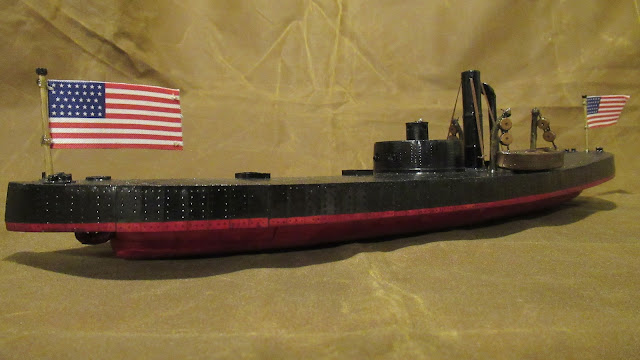
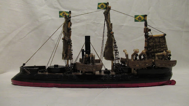
Comments
Post a Comment